noarderljocht.com
Ice and Glaciers
New Zealand Glaciers

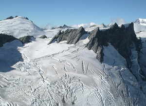
Most of New Zealand’s largest glaciers are in the Southern Alps, which have the highest mountains and heaviest precipitation. This region lies in the path of westerly airstreams which sweep persistently over the area. As moisture-laden air climbs the mountains, it cools rapidly causing heavy rains and snowfalls. Annual precipitation at the coast is about 3200 millimetres, but this rises to over 15,000 millimetres on the mountain slopes above. Glaciers in the Aoraki/Mount Cook area include the 29-kilometre-long Tasman, the Murchison (18 kilometres), the Mueller, Hooker and Godley east of the main divide, and the Fox (13 kilometres) and Franz Josef (12 kilometres) west of the divide. South of Aoraki/Mount Cook, major glaciers including the Bonar and Volta are centred around Mount Aspiring. East of the main divide in the Southern Alps, up to 20 metres of fresh snow may be added each year to the upper Tasman and Hooker glaciers. Even greater volumes fall on the western side of the Southern Alps.
Iceland Glaciers

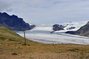
About 10,9% of the land area of Iceland is covered by glaciers or about 11,260 square km (4328 sq. miles). By far the largest of the glacier caps is Vatnajökull in southeast Iceland with an area of 8,086 square km, equal in size to all the glaciers on the European mainland put together. Vatnajökull glacier is up to about 800m thick. Other large glacier caps are Langjökull (953 sq. km) and Hofsjökull (925 sq. km), both in the central highlands, Myrdalsjökull (596 sq. km), Eyjafjallajökull and the small Tindfjallajökull (19 sq. km) in the south, and Drangajökull (160 sq. km) in the northwest.
Canada Glaciers

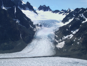
Contrasting with the vivid colouration and gentler slopes of the Rainbow Range to the east are the higher and more rugged Coast Mountains that mark the western extremity of the Tweedsmuir Provincial Park. Vast glaciers sculptured these granite giants, leaving behind serrated peaks still under the erosive attack of alpine ice. Tzeetsaytsul Peak - so named by the Indians for the rumble and boom of its glacier - and its neighbour, Thunder Mountain, are dominant features of the park’s western boundary. Monarch Mountain, in the southwest corner of the park, is, at 3,533 metres, the highest mountain in the area. Further evidence of the glacial activity of the past along the park’s west side are the deep valleys of the Bella Coola and Atnarko Rivers and ocean fjords like Dean Channel.
|
|
Gemakkelijk zoeken op Noarderljocht.....
|